 Viet Nam is located on the Indochina peninsula in Southeast Asia. It has a long land border of 4,550 km, bordering China to the North, Laos and Cambodia to the West, and Eastern Sea (South China Sea) of Pacific Ocean to the East. On the map, Viet Nam is an S-shaped strip of land, stretching from 23°23’ to 8°27’ North latitude. The country’s total length is 1,650 km from the northernmost point to the southernmost point. Its width, from the Eastern coast to the Western border, is about 500 km at the widest part and about 50 km at the narrowest part.
The country’s diverse topography consists of hills, mountains, deltas, coastline and continental shelf, reflecting the long history of geology and topography formation in a monsoon, humid climate and strong weather exposure. The topography is lower from the Northwest to the Southeast, which can be clearly observed in the flows of major rivers.
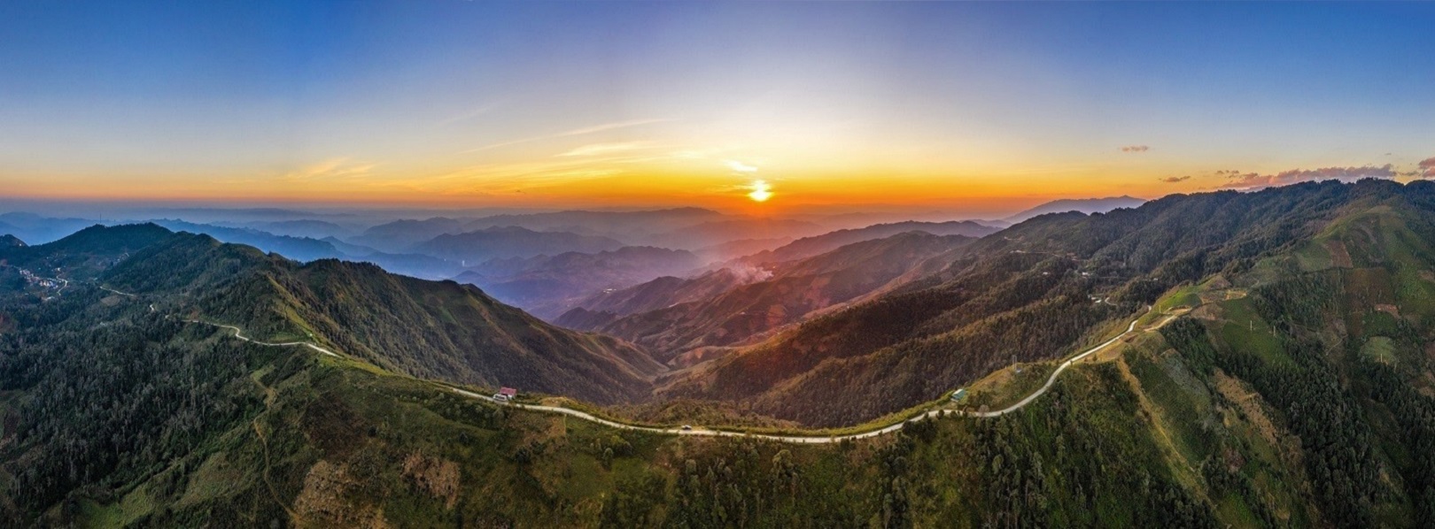
Three quarters of Viet Nam’s territory are made up of low mountains and hilly regions. Regions with elevation lower than 1,000 meters above sea level make up 85% of the territory. Mountainous regions over 2,000 meters above sea level account for only 1%. Hills and mountain ranges form a large bow, 1,400 km in length from the Northwest to the Southeast, heading towards the Eastern Sea. The highest mountain ranges are all located in the West and Northwest with the peak of Fansipan (3,143 meters), the highest in Indochina. Nearer to the Eastern Sea, the mountain ranges lower and usually end with a coastal strip of lowland. From Hai Van Pass to the South, the topography is simpler. Long limestone mountain ranges are replaced by large granite mountains followed by a vast plateau known as the Central Highlands behind Truong Son Range to the East.
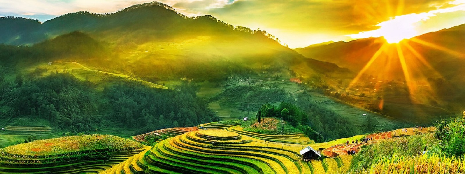
Only one-fourth of the Vietnamese territory is covered by deltas, separated into regions by mountains and hills. There are two major deltas with fertile arable land in Viet Nam, the 16,700 sq km Red River Delta, locally known as the Northern Delta, and the 40,000 sq km Mekong River Delta, or the Southern Delta. Between these two major deltas is a chain of small and narrow deltas along the Central coast from the Ma River basin in Thanh Hoa Province to Phan Thiet with the total area of 15,000 sq km.
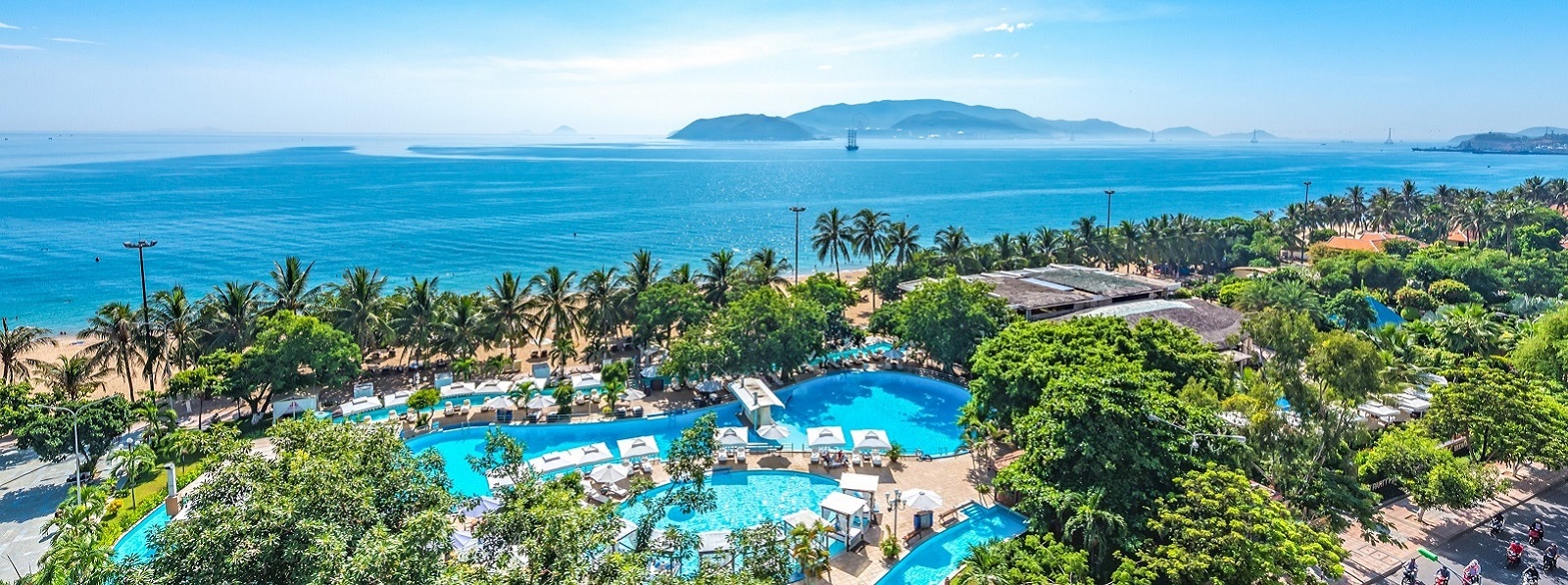
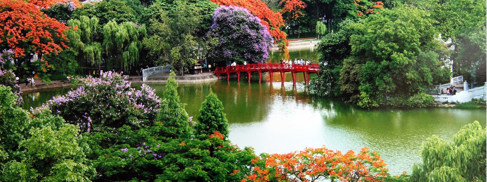
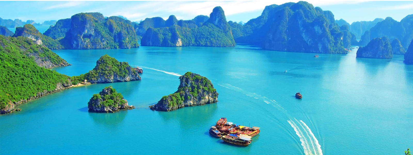
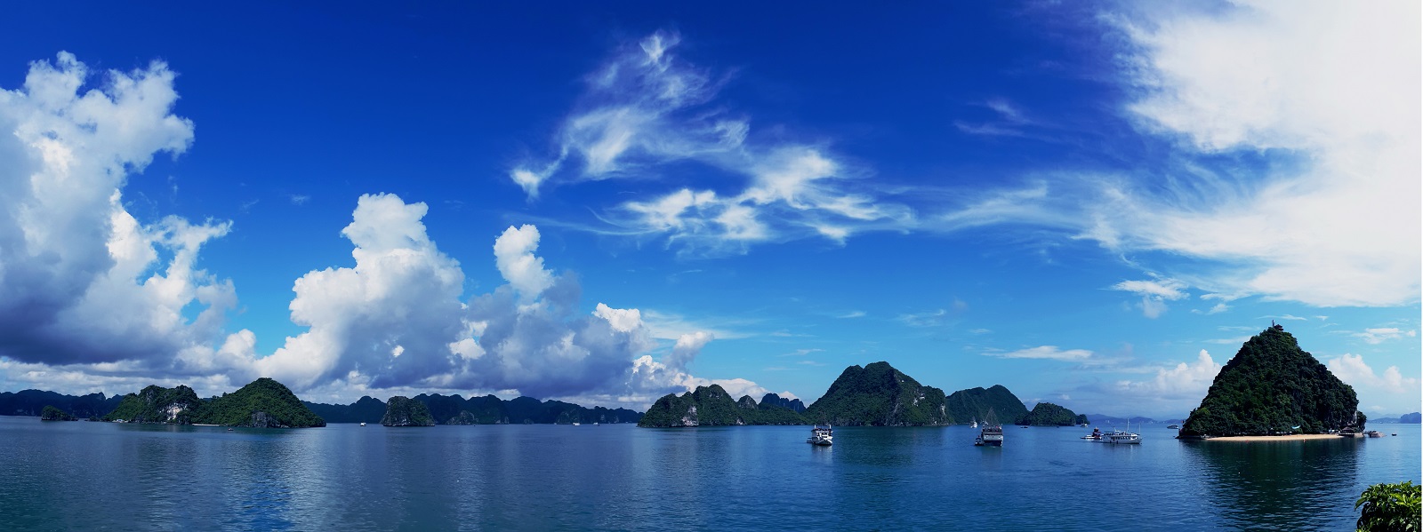
Viet Nam faces the Eastern Sea to the East and the Gulf of Thailand to the South and Southwest. The country has a long coastline of 3,260 km running from Mong Cai in the North to Ha Tien in the Southwest. Viet Nam’s territorial waters in the Eastern Sea extend to the East and Southeast, including the continental shelf, islands and archipelagoes. There is a group of around 3,000 islets belonging to Viet Nam in the Tonkin Gulf, including Ha Long Bay, Bai Tu Long Bay, Cat Hai, Cat Ba and Bach Long Vi Island. Farther in the Eastern Sea are Hoang Sa Archipelago (Paracel Islands) and Truong Sa Archipelago (Spratly Islands). To the West and the Southwest, there are groups of islands including Con Son, Phu Quoc and Tho Chu.
Climate
Viet Nam is located in the tropical zone. Its climate is characterized by high temperature and humidity all year round. The Northern part, under the impact of the Chinese mainland, has more or less mainland climate. In addition, the Eastern Sea greatly affects the country’s tropical monsoon climate. As the monsoon climate does not spread evenly, there are different regions with different climates all over the Vietnamese territory. Viet Nam’s climate changes by seasons and by regions from the lowland to the highland, from North to South and from East to West. Given the strong influence of the Northeast monsoon, the average temperature in Viet Nam is lower than that of many other Asian countries of the same latitude.
There are two major climate regions in Viet Nam: (1) Northern Viet Nam (from Hai Van Pass northwards) has a highly humid tropical monsoon climate with four distinguishable seasons (spring, summer, autumn and winter) and is influenced by the Northeast and Southeast monsoon. (2) Southern Viet Nam (from Hai Van Pass southwards) has a rather moderate tropical climate given the weak influence of monsoon and is characterized by dry and rainy seasons and warm weather all year round.
In addition, given its topographical structure, Viet Nam also has some sub-climate regions including temperate climate regions, such as Sa Pa (Lao Cai Province) and Da Lat (Lam Dong Province), and mainland climate regions, such as Lai Chau and Son La, all of which are ideal places for tourism.
The average temperature in Viet Nam varies between 21°C and 27°C and gradually increases from the North to the South. In the summer, the average temperature is 25°C (Hanoi 23°C, Hue 25°C, Ho Chi Minh City 26°C). In the winter, the temperature in the North reaches the lowest in December and January. In Northern mountainous regions like Sa Pa, Tam Dao and Hoang Lien Son, the temperature sometimes reaches 0°C with snow.
Viet Nam has a considerable amount of solar radiation with the number of sunny hours varying between 1,400 and 3,000 per year. The annual average rainfall stands between 1,500 mm and 2,000 mm. Air humidity is around 80%. Given the influence of monsoon and complex topography, Viet Nam is prone to natural disasters like typhoons, floods and droughts.
Rivers
 Viet Nam has a dense network of rivers and streams (2,360 rivers longer than 10 km), flowing in two main directions: Northwest-Southeast and bow shape. The Red River and the Mekong River, the two largest rivers in Viet Nam, create two vast and fertile deltas. Each year, the rivers and streams are supplied with 310 billion cubic meters of water. The water supply for rivers and streams depends on the flood and drought seasons. 70%-80% of the annual water volume is provided in the flood season.
Land, Flora and Fauna
Viet Nam’s soil is diverse with high fertility, thus providing favorable conditions for the development of agriculture and forestry. Viet Nam is also endowed with abundant and diverse flora of around 14,600 plant species. Viet Nam’s flora is mainly covered by tropical forests with plants and trees adapted to strong sunlight, high temperature and humidity.
The fauna in Viet Nam is also abundant and diverse with various precious species listed in the World Red Book. 275 species of mammals, 800 species of birds, 180 species of reptiles, 80 species of amphibians, 2,400 species of fish and 5,000 species of insects have been identified so far. (Dense forests, limestone mountain forests, and multi-canopied forests provide habitat to different species of monkey, languor, gibbon and wild cat. Vietnamese typical languor species include white-headed languor, delacours languor and black languor. Likewise, there are valuable bird species like pheasant and pheinardia ocellata. The high mountains in the North have many wild furred animals like selenarto, small bear, big black squirrel, fox, otter and civet).
There are national parks of high bio-diversity such as Hoang Lien Son National Park (Fansipan Mountain area, Lao Cai Province), Cat Ba National Park (Quang Ninh Province), Cuc Phuong National Park (Ninh Binh Province), Pu Mat National Park and Phong Nha – Ke Bang National Park (Quang Binh Province), Bach Ma National Park (Thua Thien Hue Province), Con Dao National Park (Con Son Island in Ba Ria – Vung Tau Province), and Cat Tien National Park (Dong Nai Province), etc. These parks are ideal places for Vietnamese and foreign scientists to conduct research and also eco-tourism attractions. Additionally, UNESCO designates 8 World Biosphere Reserves in Viet Nam, including Can Gio, Cat Tien, Cat Ba, Red River Delta, Cu Lao Cham, Mui Ca Mau, etc.
Comment